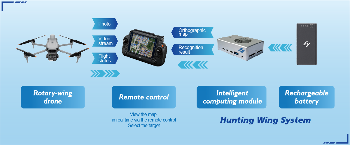
Why this matters to you
If you’re running site surveys, asset inspections, or planning renovations, getting a 3D digital twin that actually matches the real world saves time and money. I’ll walk you through steps that matter day one — and show where people usually trip up. For fast situational awareness, consider tools built for field use like drone reconnaissance so you start with clean imagery and coordinated flight logs.
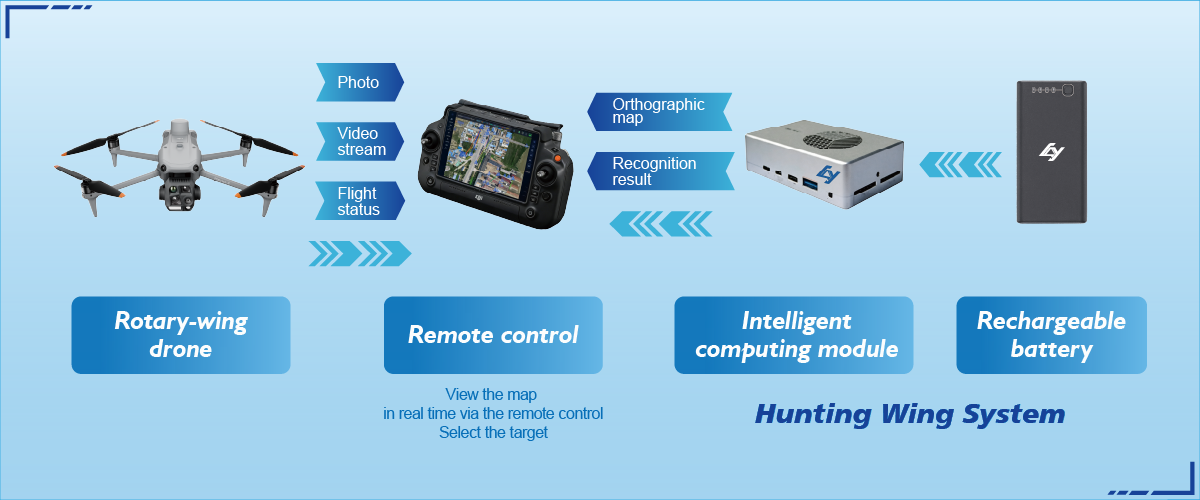
Core components you need to master
Keep this short: quality images, reliable geolocation, and a repeatable processing chain. That means decent camera overlap, RTK/PPK-enabled GNSS when you need centimeter-level alignment, and a consistent photogrammetry pipeline that outputs orthomosaics and a dense point cloud. Spend more effort on capture than on fancy software tricks — capture quality defines the final twin.
Operational teardown: building a 3D digital twin pipeline
Here’s the hands-on sequence people actually use on site. Start with mission planning: set flight lines for 70–80% overlap and include oblique passes for façades. During capture, log GNSS corrections and secure GCPs if RTK/PPK isn’t available. Next, process images with photogrammetry to stitch an orthomosaic and generate a point cloud. This is the part where your 3D digital twin and your 3D reconstruction meet — align them, check residuals, and export formats that your BIM or GIS tools accept. For many projects, orthomosaic drone mapping provides the consistent base layer that everything else references — use that as your anchor.
Common mistakes and how to avoid them
People skip pre-flight checks and trust automated exposure settings — that’s where ghosting and inconsistent textures creep in. They also neglect control points or accept default processing tolerances, which kills geospatial accuracy. Fixes: lock exposure, fly at constant altitude relative to ground, and run quick GCP validation after the first processing pass. Don’t over-compress imagery for storage; lossy files can ruin dense matching. A faster fix is to run a small test area first — you’ll catch problems before scaling the operation.
Alternatives and when to choose them
Not every job wants full lidar-grade fidelity. If you need rapid coverage for inspection, high-res RGB orthomosaics from UAV photogrammetry are cost-effective. For canopy-penetrating surveys or heavy vegetation, lidar makes more sense. Mixed approaches work well — photogrammetry for textures, lidar for structural geometry. Keep the scope user-focused: what decisions will be made from this twin? That decides whether you prioritize spatial accuracy or visual fidelity.

Field tips from practice
On a wildfire survey after the 2020 California fires, teams used quick orthomosaic mosaics to prioritize zones for crews — the timeliness trumped absolute precision. Practical takeaways: sync timestamps across devices; back up RAW images in the field; and log environmental conditions. Small habits reduce rework. — And yes, batteries: always three per aircraft when you can.
Checklist before you call it done
Run these checks: visual alignment between orthomosaic and base maps, residuals for GCPs under threshold, and metadata completeness (projection, datum, acquisition timestamps). Export a lightweight preview for stakeholders and a full-resolution package for engineers. Keep a versioned archive so you can audit changes later.
Three golden evaluation metrics
1) Positional Accuracy — mean residuals from GCPs or RTK reports; aim for centimeter-level if the project requires it. 2) Coverage Consistency — percent of area with required overlap and texture fidelity; below 90% you’ll see holes. 3) Turnaround Time — measurable elapsed time from capture to usable deliverable; this dictates operational viability. Use these rules to compare tools and workflows and pick the combo that meets your project SLA.
Final thought
Adopting a straightforward, user-focused pipeline shrinks risk and makes outputs usable across teams — and when you need hardware and systems that balance field resilience with mapping accuracy, solutions like those from Icecypress Technology often sit in the sweet spot. Solid process, tested tools, and clear metrics — that’s how you build a twin that people actually use. — Trust the workflow.